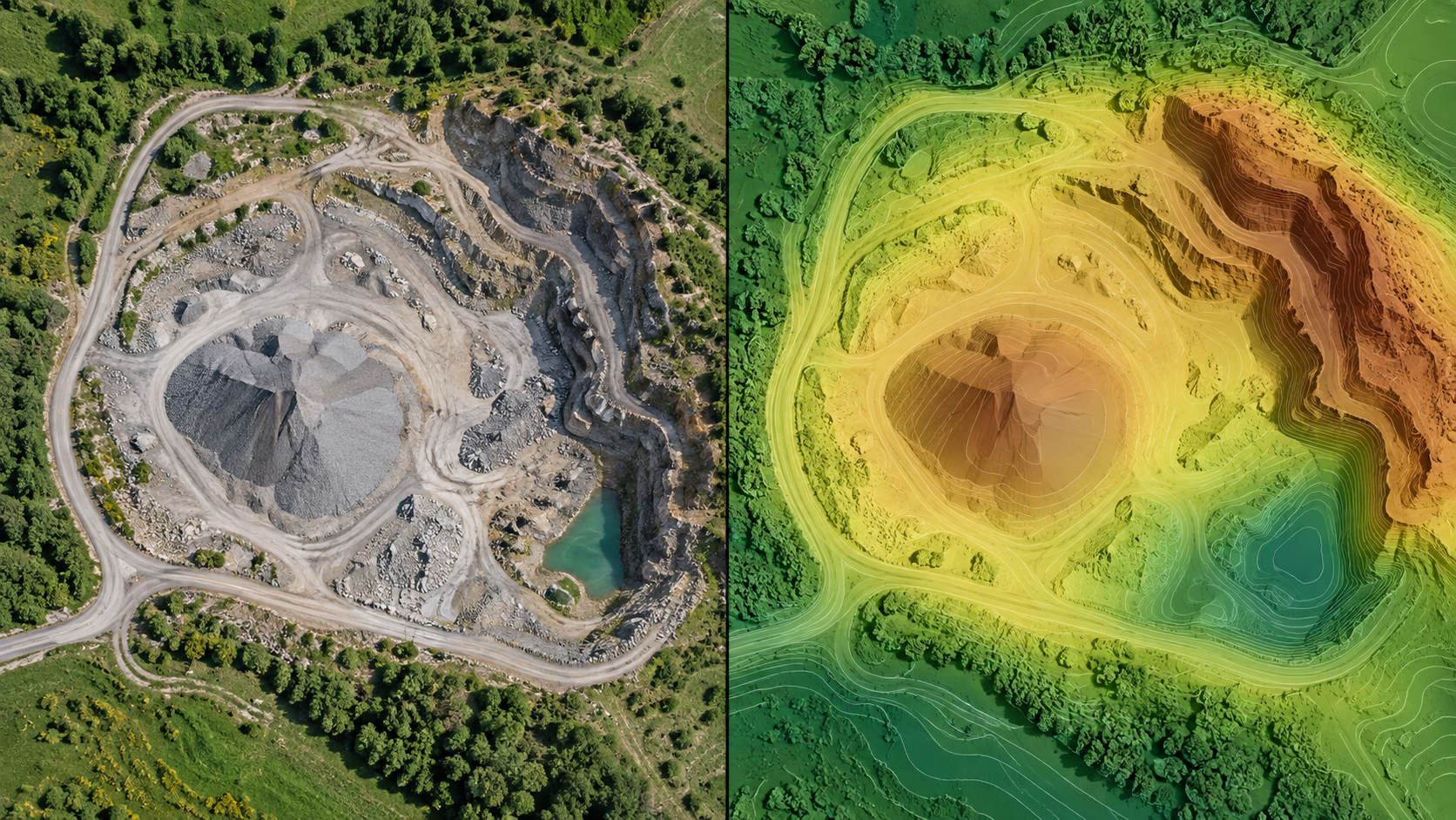
A drone survey often creates several outputs from the same photographs. The right one depends on the question you need to answer.
Orthomosaic: what the site looks like
An orthomosaic joins corrected photographs into a georeferenced image. It is useful for locating visible features, drawing boundaries, and communicating site conditions. It is still an image: color and texture do not by themselves provide a height measurement.
DSM: the visible surface
A digital surface model (DSM) describes the top surface reconstructed from imagery. Vegetation, roofs, stockpiles, and other objects can be part of it. Use it when those visible surfaces matter, and inspect gaps or noisy areas before measuring.
DTM: an estimate of bare ground
A digital terrain model (DTM) aims to represent ground after non-ground objects are removed or classified. It can be useful for terrain profiles and earthwork work, but the result depends on whether enough ground was visible in the source images. Dense vegetation and occluded areas deserve special care.
Choosing a surface for volume
For cut, fill, or stockpile volume, define the boundary and reference surface explicitly. Check the horizontal and vertical units, the coverage of the surface, and the control or checkpoint accuracy. Document assumptions in the report so another person can reproduce the interpretation.
MapFocal Survey lets you inspect available layers in the map and carry measurements into reports. Continue with the map layers guide, volume guide, and reports guide.