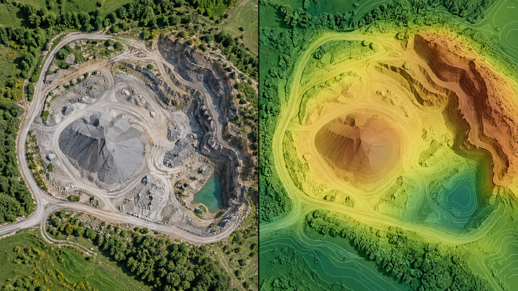
An elevation raster is only useful when you understand what its cells represent.
DSM: the visible top surface
A digital surface model includes roofs, vegetation, stockpiles, vehicles, and other reconstructed objects. It is often the right source for measuring a pile that is visible in the photographs.
DTM: an estimate of ground
A digital terrain model attempts to classify or filter non-ground objects. It cannot recover ground that was never visible, so dense vegetation and occlusion remain important limitations.
nDSM: height above ground
An nDSM subtracts terrain from the surface model. It helps visualize object height, but it inherits errors from both source surfaces.
Before measuring, confirm CRS, vertical datum, units, nodata coverage, and independent accuracy evidence. View the orthophoto beside the surface and record which revision supported the result.
Choose the surface from the question
For roof or canopy height, a DSM may be appropriate because it represents the reconstructed top surface. For earthwork against an estimated bare-ground surface, use a DTM only after reviewing classification and occlusion. For object height, an nDSM can be convenient, but a positive value is not automatically a building or tree and it inherits uncertainty from both inputs.
Inspect before analysis
View the orthophoto, point cloud, contours, and elevation raster together. Check bridges, roof edges, steep faces, thin structures, water, dense vegetation, moving machinery, and project boundaries. Interpolation may create plausible pixels where the camera never saw the ground. Nodata is often more honest than a smooth invented surface.
Confirm horizontal CRS, vertical reference, units, cell size, nodata value, capture date, and project revision. If heights are ellipsoidal but a recipient expects an orthometric datum, document and perform the correct transformation rather than applying an unexplained constant.
Resolution and accuracy are different
A raster can have small cells without being accurate to the same size. Cell spacing describes sampling; accuracy needs independent evidence such as checkpoints and a suitable survey method. Avoid statements like “2 cm accurate” based only on GSD or output resolution.
Verification workflow
Sample known locations, compare profiles across stable surfaces, check min/max statistics for impossible values, inspect contour behaviour, and reopen the exported raster in an independent GIS. Preserve the surface source, processing options, report, and checksum with any measurement derived from it.
Example surface choice
For a stockpile on a visible concrete pad, a DSM may describe the pile surface and a surveyed pad or boundary-derived base may support volume. For contours intended to describe surrounding ground, the reviewed DTM is usually the more relevant source. For a tree-height visualization, an nDSM may be useful if both canopy and terrain estimates are suitable.
Now change the setting to dense vegetation where the camera never saw the soil. A visually smooth DTM under that canopy is not direct ground observation. The correct response may be nodata, a stated classification limitation, or another field method—not stronger smoothing.
Record the question, chosen surface, rejected alternatives, classification/interpolation review, and independent evidence. That short decision log prevents a convenient layer name from becoming an unsupported measurement assumption.
Sign-off record
Before relying on the workflow, record the project and revision, source dataset, selected preset or method, coordinate and height references, units, processing version, warnings, exclusions, independent validation, and the artifact used for the decision. Reopen critical outputs in an independent viewer and keep their checksums with the report.
The reviewer should answer four questions in writing: Is the required area supported by source evidence? Does the chosen product actually answer the operational question? Are accuracy and limitations stated without inferring more than the checks prove? Can another person reproduce the result from the retained inputs and settings?
If any answer is no, hold the delivery or label the limitation. A documented stop is safer than a polished output whose assumptions cannot be recovered.